
vera methodist church
A Brief History of the Vera Methodist Church.
The story of our church began in 1890, when a handful of charter members gathered to form the “White Flat Methodist Episcopal Church South”, although some records suggest it may have been as early as 1886. At the time, Vera was known as White Flat Community, and the church was organized and met in the community’s first schoolhouse. Some references called it “White Flat School”, and some called it Howard School. For a time, the school building served as school, community center, and church for more than one denomination.
In 1903, the old school was torn down, and in 1904 the first church building was built on one acre of land donated by G.W. Ballard, a simple one room white wooden building with a small stage for the pulpit and the piano, and a little alcove on the east side that was affectionately known as the “Amen Corner”. The windows were painted to resemble stained-glass.
About this time, the community acquired a post office and the name of the community was changed to Vera; we then became the “Vera Methodist Episcopal Church South”.
The church was a spiritual home for many folks and families of different persuasions and served the community and the Lord well for 42 years, with Sunday school, Bible study classes, Methodist Youth, Women’s Missionary Society, and men’s fellowship. The building was also shared at times with the BMA Baptists and the First Christian congregations.
About 1909 or 1910 an outdoor “tabernacle” was built beside the church for services, revivals and other gatherings when the weather allowed. Special occasions called for “dinner on the ground”, an all-day affair that included preaching, singing, and unending platters of delicious home-cooked food prepared by the ladies of the church. Sometime in the early 1900’s a large bell was purchased and arrived by train from the east. That bell can still be seen in the yard beside the church.
In 1908 an acre of land east of the church building was purchased from E.E.Taylor for the construction of a parsonage, a “modern” two-story building which provided a home for many pastors to follow, and an informal gathering place for members of the community to drop by for a visit. There have been three different parsonages in the history of the church, the second one being built from the old ones from Benjamin and Vera when those two churches joined for a time. The current parsonage building, now a private residence, was completed in 1962.
In 1917 the Benjamin and Vera churches combined, with each church holding services twice a month. Through the years, the building served both those congregations and others. Quite often, Vera was part of a two or three part “charge”, meaning we shared a pastor with other communities.
In January 1946, plans were made to tear down and replace the old church building. Construction started in April of that year on the tile block building which still stands and serves. The new building held a beautiful sanctuary with pulpit and choir area with room for the piano, solid oak pews, and custom stained-glass windows provided by family memorials and shipped from the metroplex to Vera. There were classrooms to accommodate Sunday school for the area children and a new kitchen and fellowship wing for community gatherings. Services were held beginning in August 1946, although the work was not quite finished, lacking a few details. Then in March 1948, an official dedication ceremony was held for the church’s new home, with many grateful and happy people attending.
In 1968 the church voted to affiliate with the United Methodist Church, and became known as Vera United Methodist Church, although it was still mostly referred to as “Vera Methodist”. That affiliation lasted until 2022, when the congregation joined with the Global Methodist Church. We are now officially “Vera Methodist Church”, and welcome any and all who choose to come through our doors.
In the words of Edith McGaughey Beck, whose family has been an integral part of the church for six generations: “Where once a section of land supported 3 or 4 families, now one man farms many sections, and the population has declined. Gone are old familiar faces, with few to replace them, as there is little reason for the young to return, and no way for them to make a living and raise their families. The church has almost come full circle, in that the membership is not much larger than that long ago time when the first few charter members met and worshipped together and shared and cared, even as we do today.”
For many years the Vera Methodist Church has had a large and very active congregation of families and friends who gathered together, shared their lives, supported and prayed for each other. The pews are no longer filled on Sunday morning, but we remember. Sitting there in the quiet, with the sunlight streaming through the stain-glass windows, one can almost hear, and can certainly sense, the presence of the multitude of souls who at one time crossed that threshold to join in worship, singing and fellowship. Now, 134 years after that first meeting, the church is still “full”.
From Marilyn Coffman
This summary has been compiled from sources including the Knox County History, Haskell Free Press 1966, “Vera United Methodist Church History” written by Edith McGaughey Beck in 1984, and various handwritten manuscripts and records from the files of the Vera Methodist Church. Please accept my apology for any unintentional errors made in compiling the information which is available to me.
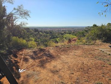
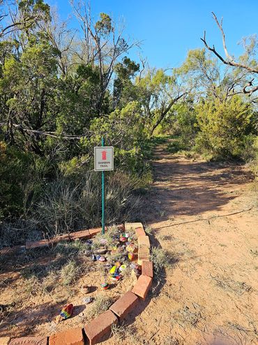
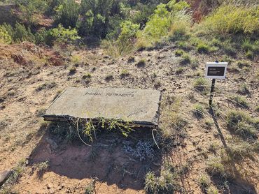
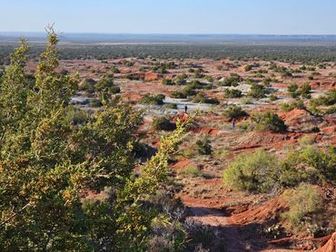
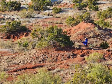
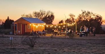
Jim Bob Art Park & Nature Trails, Big Country Arts Celebration, November 4, 2023


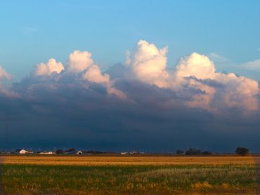
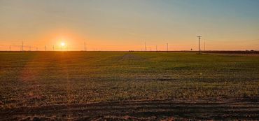
Knox County


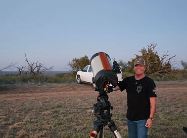
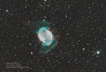
SUN calendar From Randy Barnett
The marker is a SUN calendar. Used by ancient people to know when the seasons will start changing. With a single point of reference, you mark the furthest point north (to the right) where the sun sets on the horizon. This is the official start of summer which is the longest day of the year (June 20). This is the summer Soltice.
As the sun starts its journey south (to the left), you mark the furthest point south where the sun sets on the horizon. This is the official start of winter, which is the shortest day of the year (Dec 21). This is the winter Soltice.
Exactly the mid point between the two marked Soltices is called the Equinox. The hours of daylight and darkness are the same. If the setting sun is moving to the right, this is the official start of spring (March 20). Conversely, if the setting sun is moving to the left at the Equinox, this is the official start of fall (Sept 23).
At either Soltice, if you count the number of days when the setting sun returns to the starting point, you have 365 days (one year).
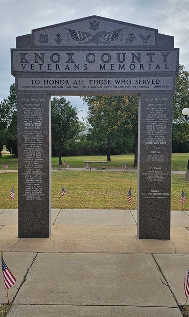
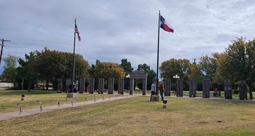
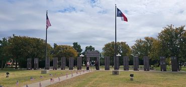
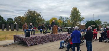
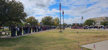
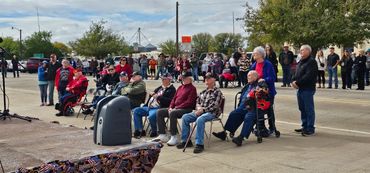
Honor Our Veterans, November 11, 2023
HOBERT FARM
Family Land Heritage
Reprinted from 1996 FAMILY LAND HERITAGE.
HOBERT FARM
Two and one-half miles north of Munday.
DATES OF OWNERSHIP/ NAMES
1893 - 1956 E. R. Hobert
1956 - 1976 L. W. Hobert
1976 - 1996 Chalmer E. Hobert
1996 - 1996 Tony R. Hobert
E. R. Hobert was originally from Eggington, Illinois. He arrived in Texas on August 29th, 1861. On February 6th, 1893, he purchased 282 acres of land from H and T. C. Ry Co. He produced cattle, cotton, milo and wheat. E. R. eventually added 140 acres to his property. In 1956, the 422 acre property passed to his only son L. W. Hobert. L. W. was one of E. R.'s three children. The other two children were Cora and Ressie. L. W. Hobert grew wheat, cotton and milo. He also raised livestock. Though he sold 70 acres of the original property, he acquired four sections of land south of Goree, TX near the Brushy Community. L. W., like his father, also had three children – Chancy, Chalmer and Donald. Chalmer became heir to the 342 acres remaining from the original family property. Chalmer E. Hobert acquired the land in 1976. He used his 352 acre property to produce cotton, wheat, potatoes, milo and cattle. Chalmer also purchased an additional 580 acres. The land consisted of four more farms that he also owned. Outside of his farm operation, Chalmer was very active. He was President of the ASCS County Commission for ten years, President of the Knox Prairie Vegetable Coop for five years, as well as founder and president of the Knox Prairie Coop for seven years. Chalmer and his wife, Virginia Holbert, had three children: Tony, Diane and Carolyn. Two years after his death in February of 1994, Chalmer’s son, Tony, took ownership to the 350 acres known as the Hobert Farm.
Tony R. Hobert is presently producing cotton, wheat, milo and cattle. As operator of the land, he is also presently living on the property.
ACRES IN ORIGINAL PARCEL: 282
ACRES HELD TODAY: 350
Crops or livestock raised. 2023 Cattle, cotton, milo and wheat.


